|
|
|
Skiing to Trefallstoelen 20th of February 2005.
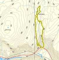
Click at the picture / title above to see pictures from the hike. Up Kyratoni, which is the east path on the map. Down again Fribakkane. Click on the map at right to see a bigger version, plus data and a bigger version of the hight profile. Deep snow and difficult to ski. A more detaile description so far only in Norwegian. |
|

|
|
Skiing to Trefallstoelen, up Kyratoni (the east path on the map), down again Fribakkane.
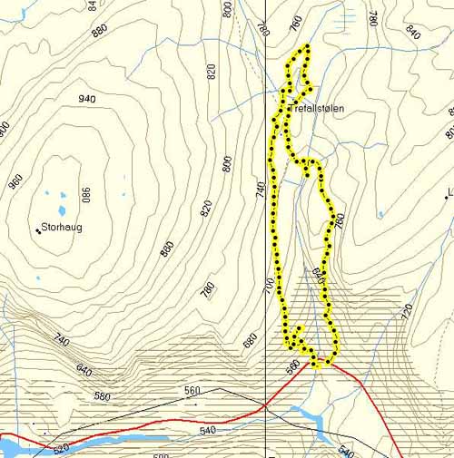
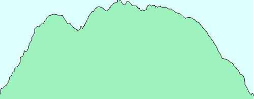
Hight profile for the hike. Starting at 547 meters above sea level. Higest point at 754 meters.
Copyright © kaare@trefall.com 2004-2023
(pgp)
Last updated 17th of April 2023